Mini Dam Site: Dhoke Budhal
District: Rawalpindi
Geographic Location: 73°1'37.404"E 33°19'59.635"N
INTRODUCTION:
General:
The Agency for Barani Areas Development (ABAD), Planning & Development Department, Government of Punjab has initiated a project namely “Rain water harvesting project for all villages in Potohar area”.
The main focus in the project is reduction in water and soil losses, enhancement in water productivity for command area development and livelihood improvement in the area. Already existing water bodies (mini dams/ponds) having atleast 20Aft.
water as well as same amount of land will be selected for resource development and its management on sub catchments basis which includes
• treatment of catchment area
• command area development and
• capacity building & community mobilization.
It will be implemented through participatory approach.
The beneficiary farmers/community groups will contribute about 50% of the intervention cost.
Location Map of Potohar Region
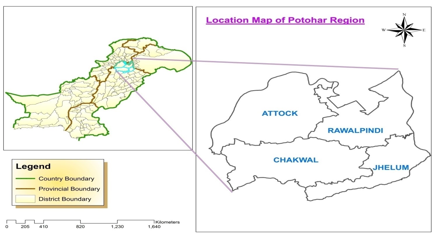 • Figure 1 :Location Map of Potohar Region in Pakistan
Project Components
Preparation of Integrated Development Plan for each Mini Dam
A comprehensive development plan for catchment and command area of each water body will be prepared with the help of a team of experts from relevant line agencies.
It will provide present status of the site as well as scope of work for its improvement in general as well as with particular reference to project interventions.
Which are as under:
A. Catchment Treatment Works :
The whole catchment area of each water body, which comprises of 2-3 Sq. Km would be treated as per integrated development plan. Treatment of catchment area will be carried out using low cost structure i.e. dry masonry and biological measures with the physical and financial participation of the community. In the catchment of each pond/dam site around 60 acre land would be treated under Soil Conservation works. The community will contribute atleast 50% of the cost. The activities of plantation of forest trees / dry afforestation will be carried out by the COs/VOs. The project will provide subsidy @Rs.5/plant on successful plantation. About 5000 plants (10 acres) would be brought under forestation on each site.B. Command Area Development:
Out of development plan about 5 Acres command area of each water body would be developed under direct supervision of experts and extending subsidy to the farmer. The following activities will be carried out in the command area:Solar Energy Irrigation System:
It will be provide to about 25% of the farmers on 50% cost sharing with maximum subsidy up to Rs.500,000/-.Promotion of Vegetable Growin:
Introduction of vegetable growing on 2 acres. Government will provide 50% subsidy maximum up to Rs.15,000/- per acre.Orchard Establishment:
Orchard would be established on about 3 acres land. 50% or maximum up to Rs.25,000/- per acre subsidy would be paid on successful completion.C. Capacity Building:
The training will be provided to the farmers regarding fruit & vegetable cultivation, livestock & fisheries development. For this purpose Workshops/seminars/ Field visits will also be arranged. The concept of Service Providers will also be introduced to facilitate the farming community.Dhoke Budhal Mini Dam
Dhoke Budhal Dam is owned by Malik Abdul Ghani located at 73°1'37.404"E 33°19'59.635"N latitude and longitude in Tehsil & District Rawalpindi.
It is about 54Km from Rawalpindi on Chak Beli Khan Road and 4.5Km from village Dhoke Budhal,
approachable through BANDA road as shown in figure 2.
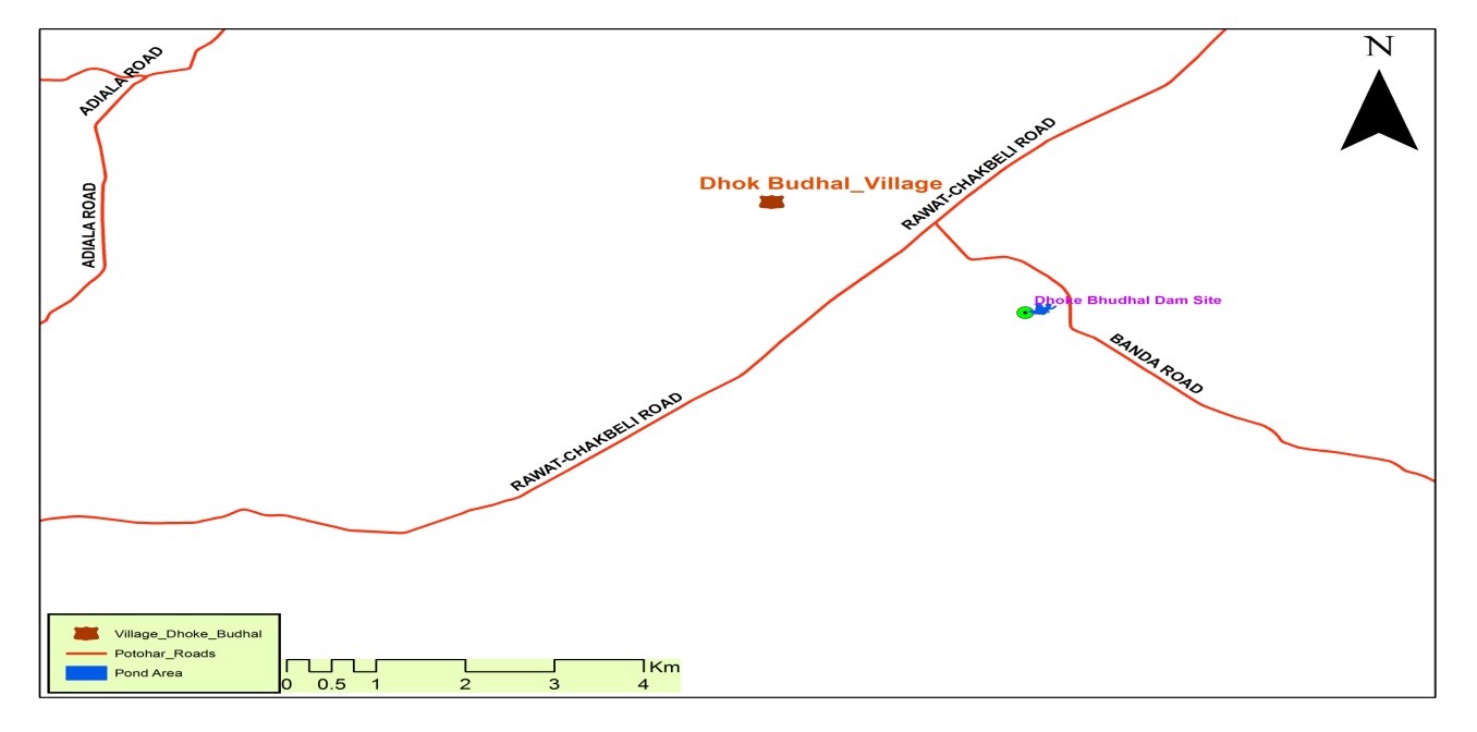 • Figure 2 :Location map of Dhoke Budhal mini Dam site
Physical Feature of the Dam
The dam was constructed by ABAD through Soil Conservation Component in 2011 under
“WRD Project by constructed 400 mini dams”. It is earth fill with designed storage capacity of 51Aft.
The height of the dam is 27 ft. with spillway level at 22ft.
About 3200 ft long conveyance system along with Diesel Engine & Pump was also provided under the scheme
Which are as under:
Catchment Area:
The length of main stream is 1.2km and the total length of stream network is 6.9km which is calculated in ArcGIS software. There is no perennial runoff in all streams. There are two other dams exists on the upper side adjacent to the dam on the main stream. The catchment area is about 2.25 Sq. Km. The point of maximum elevation in the catchment area is 1424 ft whereas the elevation at constructed dam site is 1338 ft. Catchment area consists of agricultural fields, barren land and forest (densely located at some places and also sparse trees at some places). Topography and land cover of catchment area is shown in figure 3 & 4.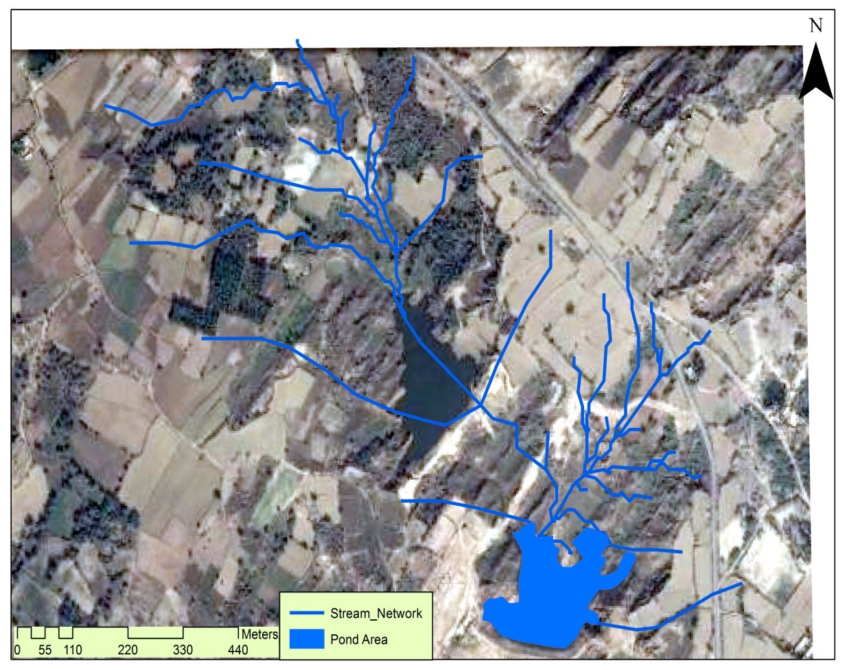 • Figure 3 :Drainage Network of Dhoke Budhal mini Dam site
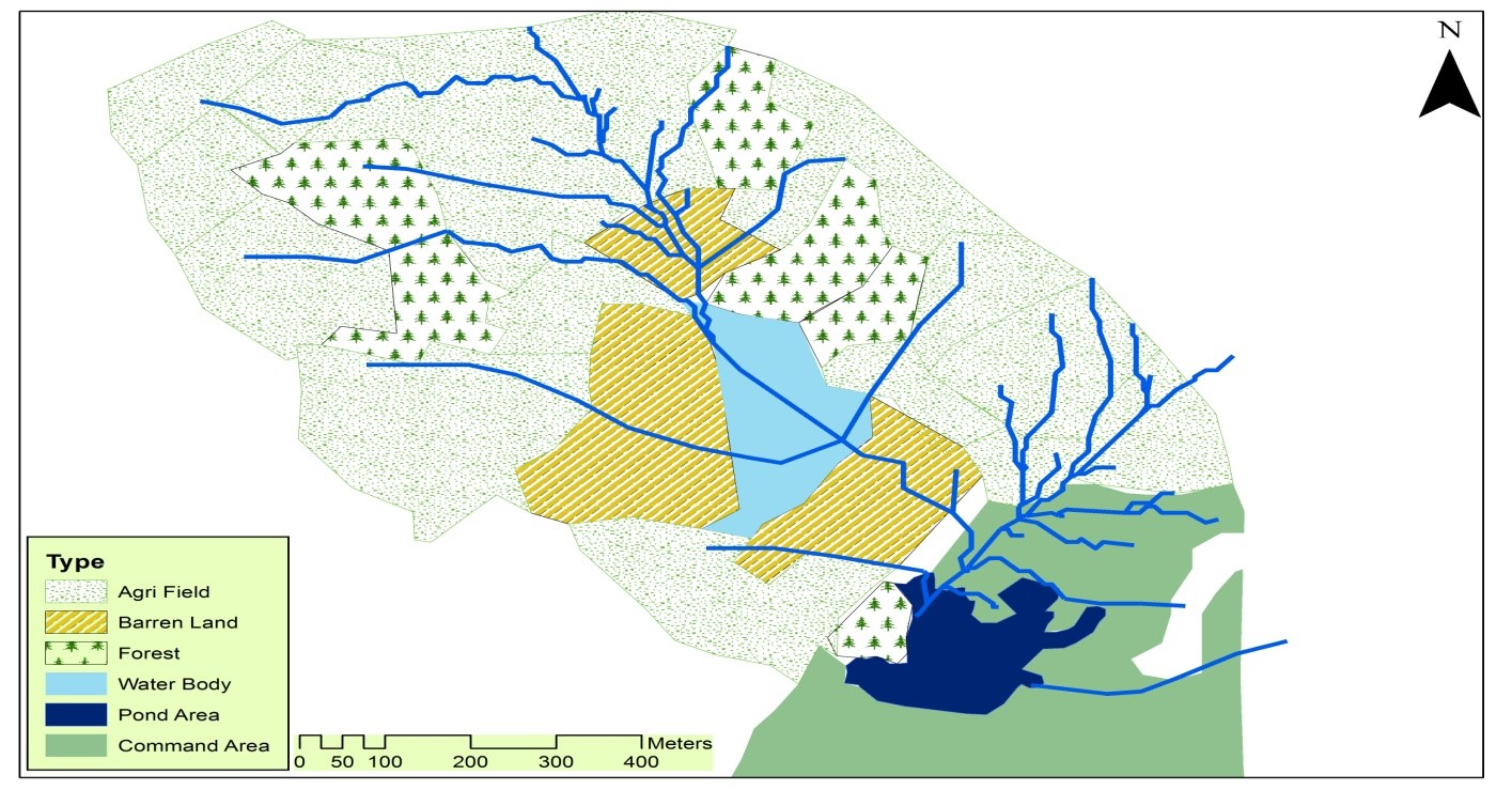 • Figure 4 :Landcover of Catchment Area of Dhoke Budhal Dam Site
Land forms and soils:
The general landform is undulating and the strata are gently or almost vertically dipped. It is divisible into undulating weather rock plains and ridge and trough uplands. Soils have been developed in residual material derived from underlying tertiary rocks consisting sandstones & Shales. The wind laid material (loess) is also present in the area. The Texture of the residual soils of the weathered rocks varies from loamy sand to silty clay. Most of the soils are derived from the sandstones and have loam and clay loam dominant texture. Soils having silty clay texture are developed in Shales.Catchment Area Development Activities:
Farmer is developing new fields at the upstream of dam to bring area under cultivated through levelling and by making terraces. In the vicinity of dam, some area is severely gullied/eroded with sparse natural vegetable (about 3 acres). Keeping in view the existing conditions, following soil conservation works are recommended:• Fruit based forestry (olive) in the gullied/eroded land with micro-catchments and check dams is recommended at site located at the upstream and in the vicinity of the dam to protect it from severe water erosion and ensure profitable use of gullied lands. The terrace protection requires installation of farm runoff harvesting structures/outlet for safe disposal of runoff. Severe erosion is found near he pond area shown at Fig.5 & 6, which need to be addressed through low cast soil conservation structures and aforestation activities.
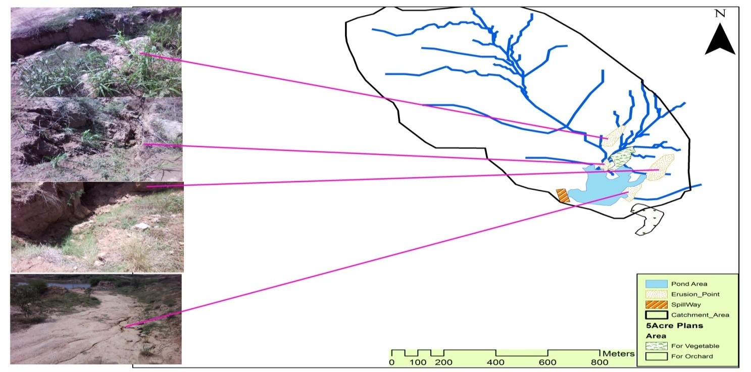 • Figure 5: (Erosion Area)
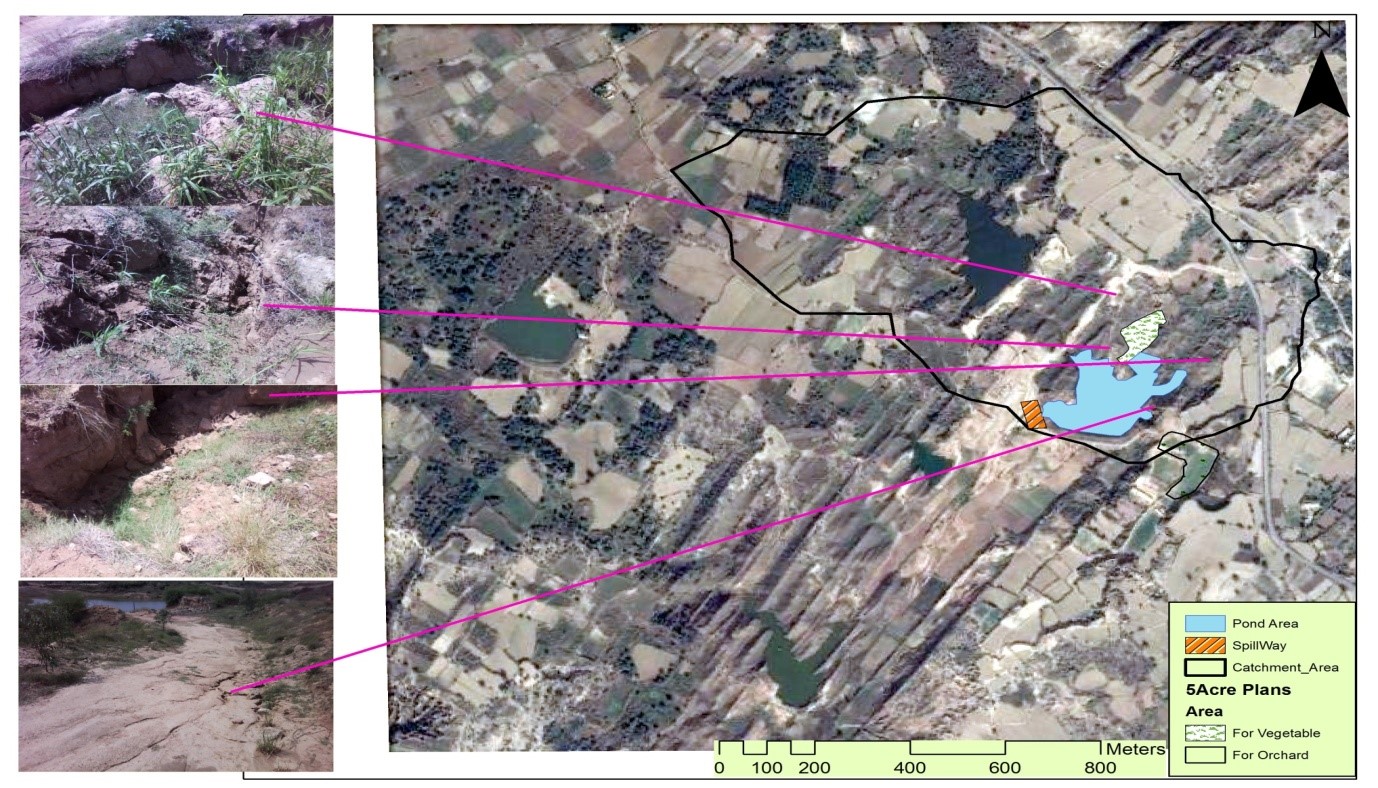 • Figure 6: (Erosion Area linked with Satellite Image)
Command Area:
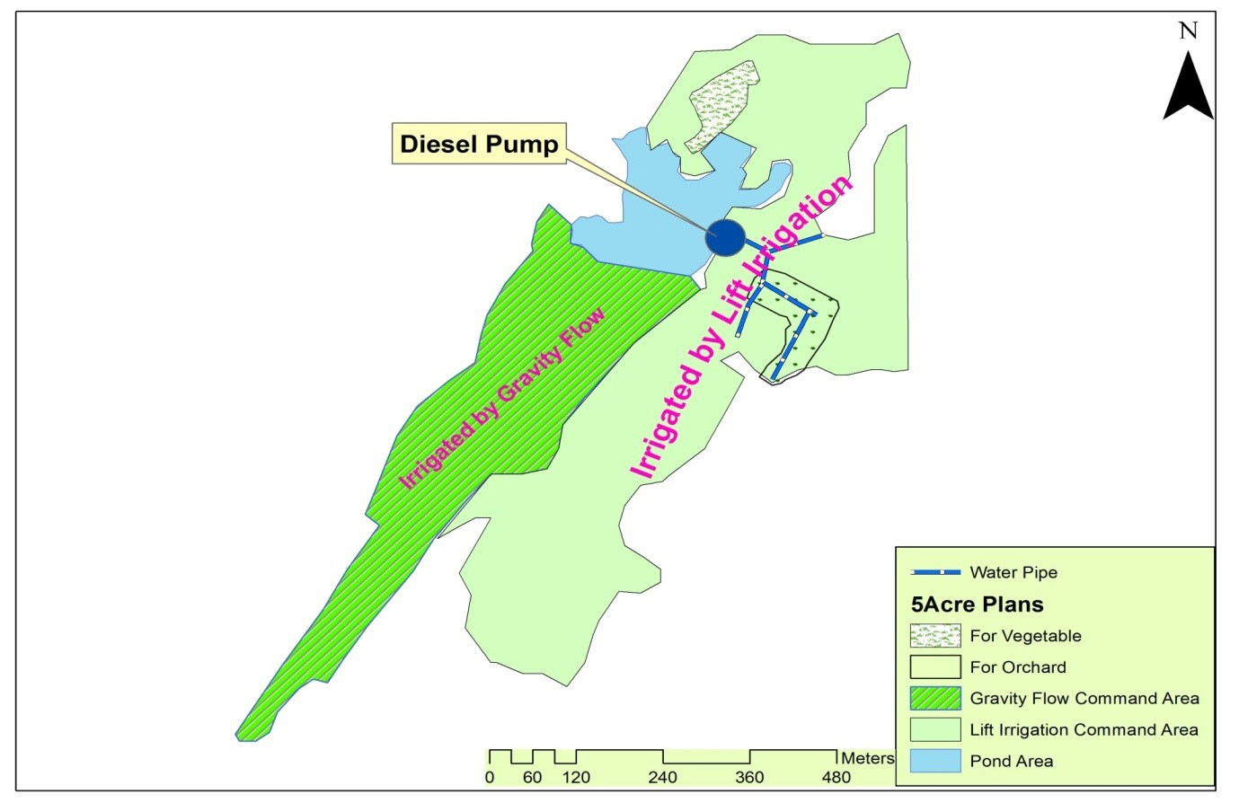
Command area of the Dhoke Budhal Dam site is 300 Kanal out of which 38% area lies below the level of water body so can be irrigated by gravity flow while 62 % is on upper reaches hence can only be irrigated through lift.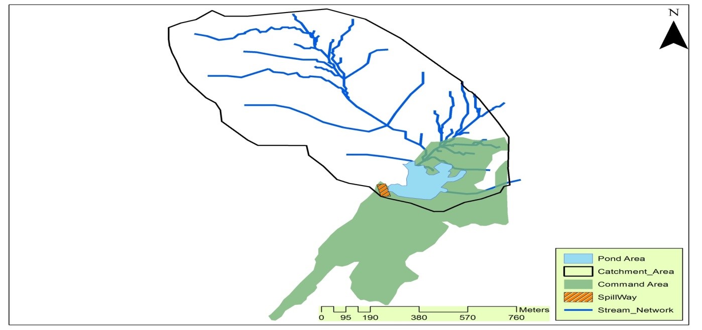 • Figure 7: (Command Area of Dhoke Budhal Dam Site)
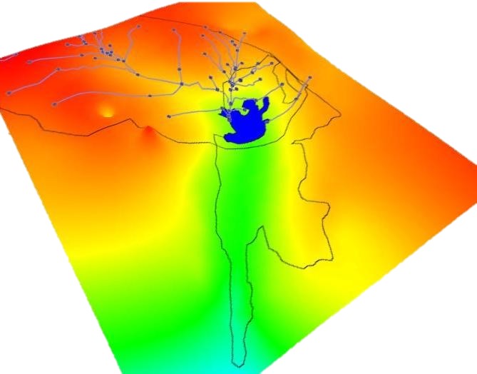 • Figure 8: Catchment/Command Area on Digital Elevation Model
Current Status of Command Area:
Most of the area has been developed for cultivation through bulldozer work after the construction of dam. Previously it was used as pasture. Most of the development spread over last two years. At present 250 Kanal is being cultivated out of which wheat was sown on 200K, maize on 35K, Groundnut on 20K and Tara-mera on 15K. 40% area is being irrigated where rest is barani. The silent features are:• Water conveyance system is installed on 100K (3200 Ft. pipe).
• Lift Irrigation by Diesel Pump.
• No Mechanism exist to irrigate land on gravity flow.
• Most of the crops are barani, only fodder crop (Maize) is being irrigated.
• Rearing 30 milking animals (24 Cattles & 8 Buffalos) and 35 calves. Selling 300 litter milk in Rawalpindi.
• About 300 Fruit plants of citrus & guava have been randomly planted along the earthen embankment.
• During year 2012, about 10,000 fingerlings were added in the pond and harvested 96 mond of worth Rs.400,000/- was sold this year in Rawalpindi Mundi.
• This year added another 14,000 fingerlings.
Recommendation for improvement of command area
1. Development Plan for 3 acre Orchard and 2 acre Vegetable:
After visit of expert team from different organizations a combine decision taken by experts on 5 Acres land for orchard and Vegetable based on land suitability, installed water conveyance system and soil quality. Figure 9 shows 3 Acre plan for orchard (citrus, Grapes and Olive) and 2 Acre for Vegetable (Peas, turnip, raddish, okra, tinda, gourd). Out of these two acres, one acre will be planted in Rabi and one acre in kharif Season. The proposed orchard site is almost developed whereas the land for vegetable needs preparation. The farmer agreed to develop as per direction of the department. After discussion with the owner, it was decided that citrus orchard would be established on 3 acres of land while one acre of radish & turnip during winter and one acre okra & tinda/gourd will be soon during kharif season.
 • Figure 9: 5 Acre Plan for Orchard and Vegetable
2. General Recommendation for rest of the area:
To improve the fertility status of newly developed land it is recommended that cowpeas should be soon for green manuring during this summer. Fodder is also need of the farmer to run his dairy farm/livestock. So it is suggested growing Chakwal-Sorgam, maize as a fodder crop during summer and Barseem, oats during winter.