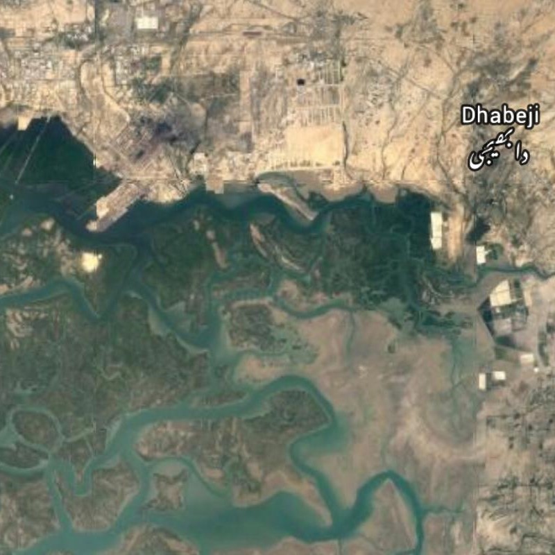
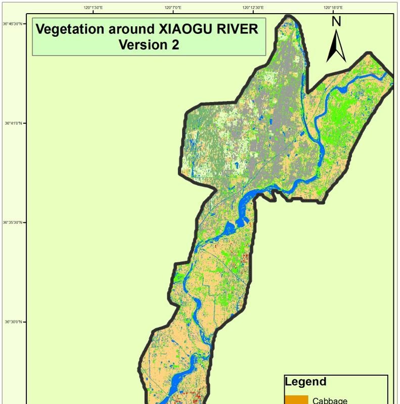
My Ph.D. research focused on the assessment of vegetative land use with satellite image processing and GIS. It enabled me to assess vegetation and its interaction with environment on spatio-temporal scales. My doctoral thesis can be assessed from: Copy of Ph.D.Thesis to know the details. During my Ph.D. research, I developed a method to verify the European subsidy claims by farmers and its outcomes were well acclaimed not only by the scientific community but also by the popular media. Such as: Ducth Media I have earned competitive research grants and industrial competitive projects on use of geospatial technologies for ground water and allied disciplines. I have executed national and international projects (in Australia and China) pertaining to remote sensing and GIS applications in water resources, agriculture and natural resources. Details of some of the projects can be obtained from the following links: http://aciar.gov.au/files/factsheet_lwr_2015_036_updated_2.pdf https://researchoutput.csu.edu.au/en/publications/optimising-canal-and-groundwater-management-to-assist-water-user- In addition to above, I have a vast experience of industrial projects which need a strong focus on clients and their requirements. I have enlisted some of my industrial/commercial projects as well. I was also selected and served as Lead Trainer for Inter Islamic Network on Space Technology (ISNET) and Inter Islamic Network on Information Technology (INIT). The training of ISNET was held in Dakar, Senegal and two training of INIT were held in CIIT, Islamabad, Pakistan. I have more than 25 impact factor publications in ISI indexed Journals..
Mobushir Riaz Khan
mobushir.riaz@icloud.com
Ph.D.• 2011
Ph.D. Applied Remote Sensing and GIS
Graduate Certificate• 2008
Production Ecology and Resource Conservation (Applied Remote Sensing and GIS)
M.Sc• 1999
Master of Science Agriculture (Insect Resistance Modelling)
Training• 2005
Decision Support System of Agro-technology Transfer
Swinburne University of Technology• 2018 - Present
Faculty Science Engineering and Technology (FSET)
Ecoseal Developments Pty Ltd • 2017 - Present
Remote Sensing & GIS Consultant
Institute of Geo-Information & Earth Observation, PMAS-Arid Agriculture University • 2016 - 2017
Institute of Geo-Information & Earth Observation, PMAS-Arid Agriculture University Pakistan
Ecoseal Developments Pty Ltd • 2015 - 2016
GIS, Ecoseal Development Pty
Institute of Geo-Information & Earth Observation, PMAS-Arid Agriculture University Pakistan • 2013 - 2015
Institute of Geo-Information & Earth Observation, PMAS-Arid Agriculture University Pakistan
I have experience of teaching Remote Sensing and GIS related subjects for Natural resources management
• 2014- 2018
• 2012 - 2018
• 2011 - 2018
• 9-14 July 2012; Dakar, Senegal
• 11-15 March 2013
United Nations/Pakistan International Workshop on Integrated Use of Space Technologies for Food and Water Security
Details
• May 11 to 20, 2015
• March 28 to 30, 2016
• November 2015
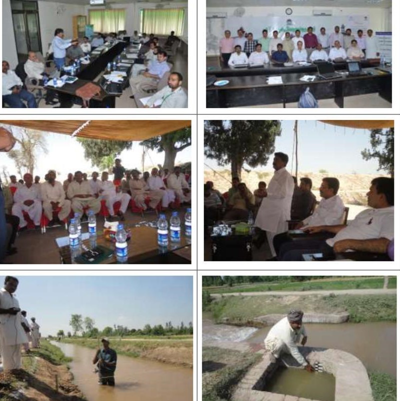
The project is in progress since 2017 towards effective groundwater use for social, economic and environmental benefits. The core of this project is collaboration through partnerships to address the complexity of achieving effective and fair groundwater management. This project aims to build the capacity of researchers, farmers, farming communities and relevant govern-ment and non-government agencies to improve groundwater management in ways that en-hance farming family livelihoods in Pakistan. Details can be accessed at: https://www.csu.edu.au/__data/assets/pdf_file/0011/2703845/Ground-_Water_FAC_sheet.pdf.
FUNDED BY: AUSTRALIAN CENTER FOR INTERNATIONAL AGRICULTURAL RESEARCH (ACIAR)Training of groundwater and econometric models to end users including technical staff of De-partment of Irrigation and faculty members of relevant Universities in Punjab. I was responsi-ble for development of curriculum, deliver of lectures and hands on exercise for GIS and Re-mote Sensing training component. .
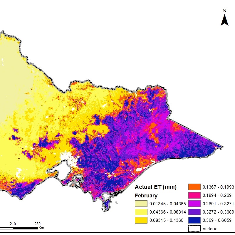
FUNDED BY: AUSTRALIAN CENTER FOR INTERNATIONAL AGRICULTURAL RESEARCH (ACIAR) as SRA RESEARCH GRANTDSS for irrigation management using remote sensing and GIS, Satellite image processing was done for mapping crop areas, Estimation of Crop evapotranspiration and GIS support in the pro-ject for ground water modelling.
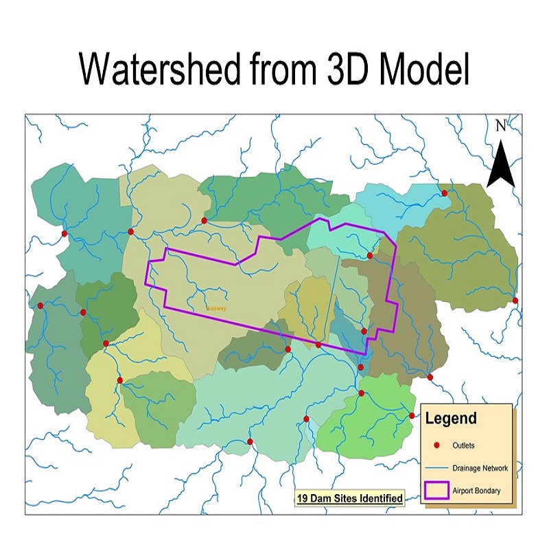
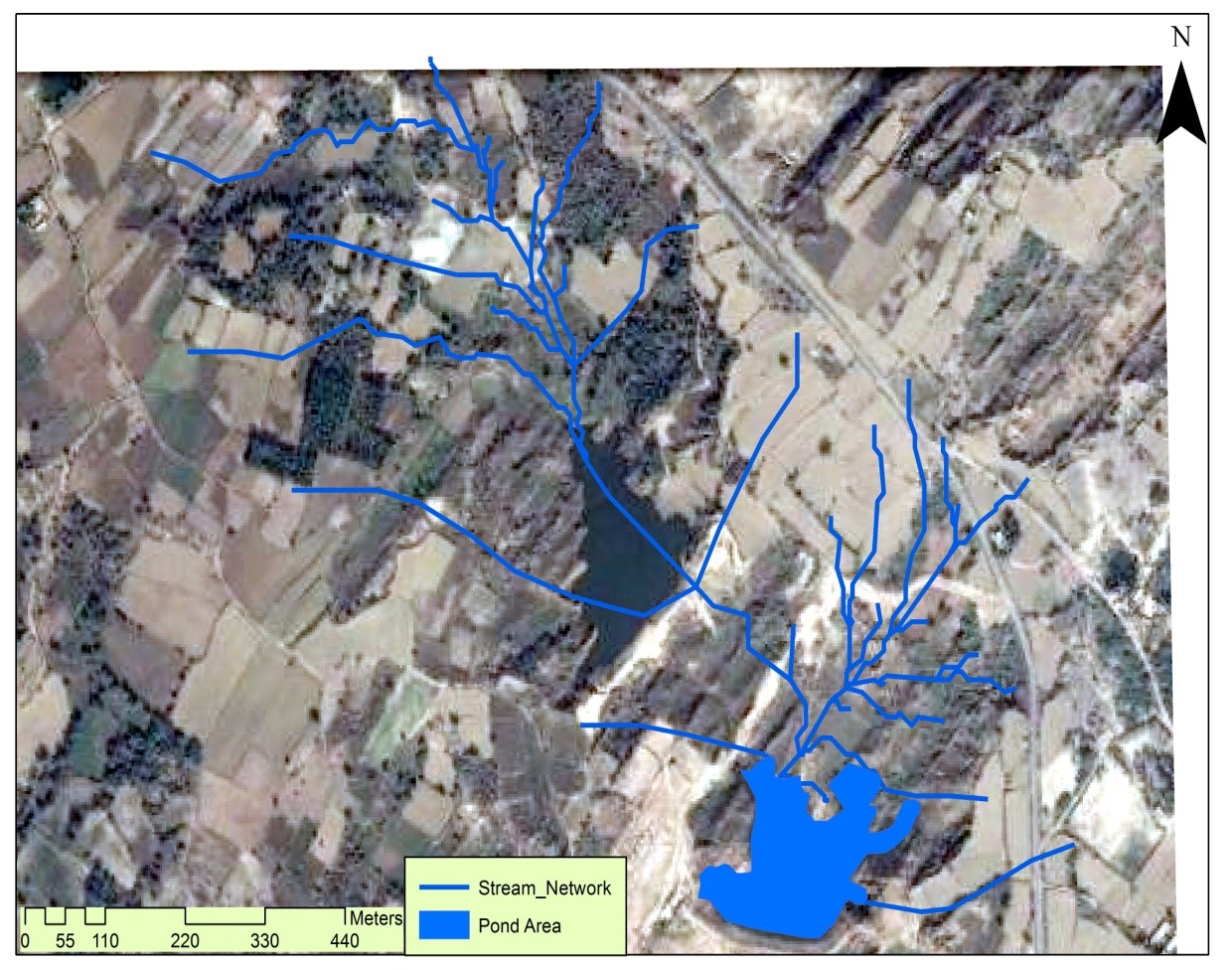
FUNDED BY: AUSTRALIAN CENTER FOR INTERNATIONAL AGRICULTURAL RESEARCH (ACIAR)The project intended to identify rain water harvesting sites using high resolution Digital Eleva-tion Model which was generated by analysis of stereo-pair images obtained from ALOS satel-lite data. Total of 192 catchments were identified in Rajanpur rod-kohi area using digital eleva-tion model (DEM) data in SWAT- Soil and water assessment tool hydrological model.
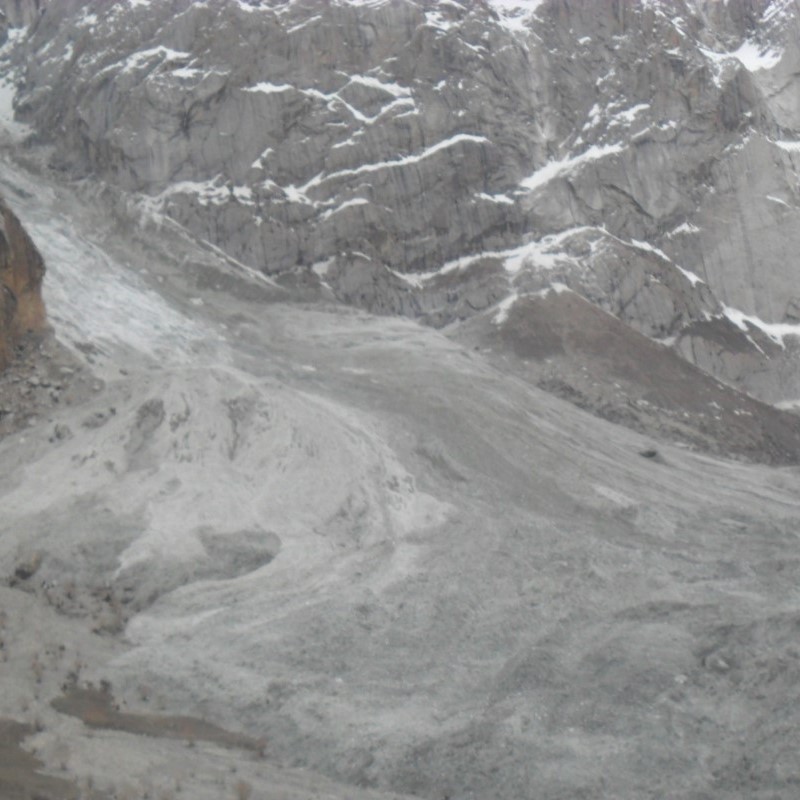
FUNDED BY: PAKISTANT AGRICULTURAL RESEARCH COUNCIL (PARC) Research for Agricultural Development Program (RADP)Studies on Snow cover dynamics using MODIS, field and meteorological data. Satellite images were used to detect changes in snow cover in HKH region at various heights and orientation. Further, those areas were identified which were more prone to disasters (avalanches, and floods).
FUNDED BY: MINISTRY OF DEFENCE, GOVERNEMENT OF PAKISTAN (MoD)The project focused on the issues of coastal ecology and community problem due to the chang-es in climate. The project aimed to improve coping capacities among communities and gov-ernment partners. Local communities, in this context, were particularly vulnerable as they were exposed to storm surges, cyclones, sea level rise and sea water intrusion and livelihood dis-turbances such as reduced fish stocks and unsafe sea due to extreme weather systems.
FUNDED BY: ASIAN DEVELOPMENT BANK (Lead Scientist on Behalf of GIS Geeks & Govt of Sind, Pakistan)MODIS NDVI data for 2013-14 was downloaded and stacked. Firstly, cluster analysis was done and temporal signatures along with corresponding maps were generated. Secondly, those temporal signatures were linked to crop calendar/phenology of various crops to find what is grown and where it is grown. Thirdly, data mining was done to perform subpixel classification and it was estimated that in each pixel how much percent of various crops and other land-uses exist. Lastly, validation was done using field data provided by BWI and final output was handed over to the company.
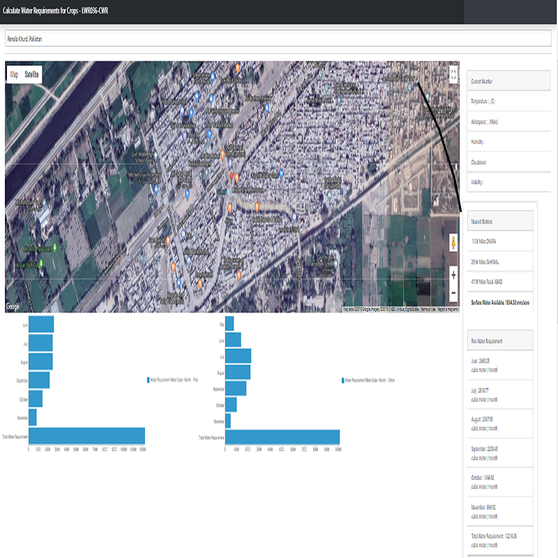
FUNDED BY: Beijing Water International (BWI), Beijing ChinaThe communities are benefited through provision of following information through this application.
• Current weather parameters for their farm.
• Can easily calculate crop water requirements with three clicks.
• Can compare various options of crops and their water needs.
• Can see what rainfall and surface water supply in his/her region is.
• The application can be used in combination with Apna Farm module where crop profitability, soil type and GW depth are available.
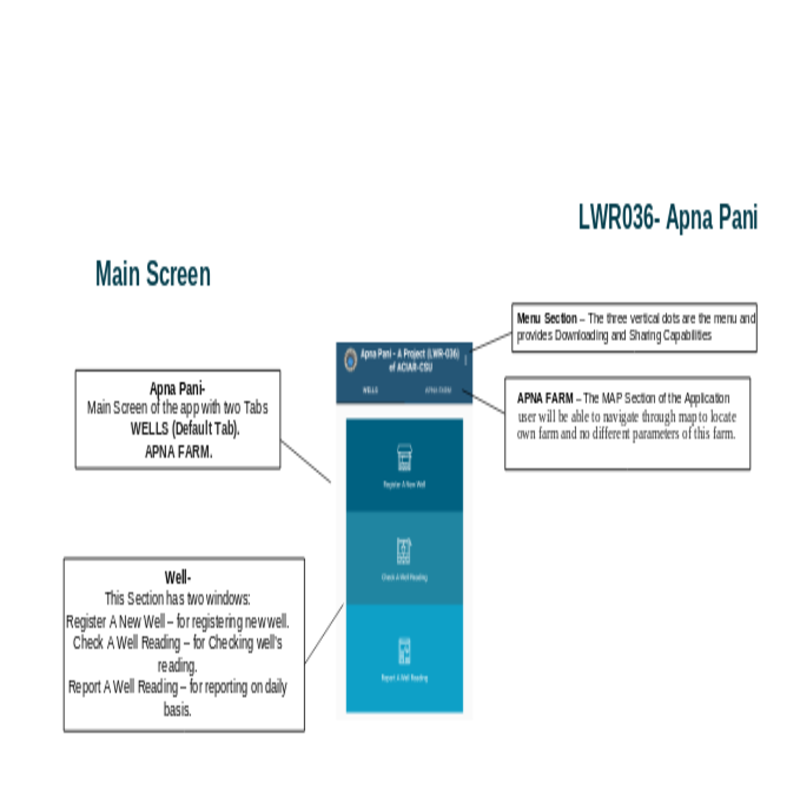
Wells: Available any where
• Record the well information (Owner Name, Location, and Custom name for each entry).
• Report a well reading on daily basis, each of the reading will have well name or Well ID, EC or Depth to Water.
• Check all the wells and their readings on graphs.
•Export data as CSV.
APNA FARM: Currently available for only Punjab.
• APNA FARM is a module of Apna Pani which is the backbone of the farm management.
• APNA FARM displays information about land on the Map.
• The information includes: 1. Weather 2. Soil Type 3. Soil Fertility 4. GW Depth 5. Profitability
GIS aided by satellite remote sensing were used in the entire planning. GIS provides the tools necessary to research, develop, implement, and monitor the progress of a project and manage site location, economic analysis and other critical facets. The planning aspect of a survey project has a number of unique requirements depending on its area, purpose, and overall goal. GIS technology helps full these demands by facilitating traditional tasks more efficiently and easily accomplishing new tasks that were previously impractical or impossible.
Survey Planning ProjectThe Agency for Barani Areas Development (ABAD), Planning & Development Department, Government of Punjab has initiated a project namely “Rain water harvesting project for all villages in Potohar area”. The main focus in the project is reduction in water and soil losses, enhancement in water productivity for command area development and livelihood improvement in the area. Already existing water bodies (mini dams/ponds) having atleast 20Aft. water as well as same amount of land will be selected for resource development and its management on sub catchments basis which includes • treatment of catchment area • command area development and • capacity building & community mobilization. It will be implemented through participatory approach. The beneficiary farmers/community groups will contribute about 50% of the intervention cost.
Dam Planning Project
• APNA FARM is a module of Apna Pani which is the backbone of the farm management.
• APNA FARM displays information about land on the Map.
• The information includes:
1. Weather information
2. Soil Attributes
3. Water Requirement Calculation For Crops With Graphs.
4. Crop Profitability Graphs.
• Journal Paper
Sarhad Journal of Agriculture, 32(2), 400-413.
• Journal Paper
International Journal of Climate Change Strategies and Management, 9(1), 21–35.
• Journal Paper
The Journal of Infection in Developing Countries, 11, 207–211.
Continue Reading
• Journal Paper
The Korean Journal of Parasitology, 54, 439–446.
• Journal Paper
International Journal of Geosciences 7 (10), 1191-1207.
• Journal Paper
Pakistan Journal of Zoology, 46, 513–520.
• Journal Paper
The Journal of Infection in Developing Countries, 9(8):914-916.
Continue Reading
• Journal Paper
Kafkas Universitesi Veteriner Fakultesi Dergisi 20 (1), 35-40.
• Journal Paper
Hydrology and Earth System Sciences, 10, 4077-4100.
• Journal Paper
Kafkas Üniversitesi Veteriner Fakültesi Dergisi, 19 (6):1017-1022, 2013
• Journal Paper
Kafkas Üniversitesi Veteriner Fakültesi Dergisi, 18, 215–219.
• Journal Paper
Journal of Himalayan Earth Sciences 46(1) (2013) 89-98.
• Journal Paper
Pakistan J Zool 45 (6), 1495-1500.
• Journal Paper
Pak. J. Zool 44 (3), 759-764.
• Journal Paper
Tropical Biomedicine, 33.
• Journal Paper
Pakistan Journal of Zoology, 47, 1147–1155.
• Journal Paper
Kafkas Üniversitesi Veteriner Fakültesi Dergisi, 2(6): 849-854.
• Journal Paper
Kafkas Univ. Vet. Fak. Derg, 20, 655-662.
• Journal Paper
Phytoparasitica, 42.
• Journal Paper
Kafkas Üniversitesi Veteriner Fakültesi Dergisi, 19, 79–84.
• Journal Paper
Pakistan Journal of Zoology, 45, 453–458.
• Journal Paper
Pakistan J. Zool., 43(5), 1009-1012.
• Journal Paper
Pakistan J. Zool., vol. 46(4), pp. 953-958.
• Journal Paper
Ent. Monogr. Maga., 141, 219–226.
• Journal Paper
International Journal of Applied Earth Observation and Geoinformation, 12, 2010, 36–46.
• Journal Paper
International Journal of Biosciences, 13(1), 148-158.
Continue Reading
• Journal Paper
Hydrology and Earth System Sciences Discussions, 10, 2013, 13145–13190.
• Journal Paper
The Journal of Infection in Developing Countries, 09, 2015, 872–877
Continue Reading
• Journal Paper
International Journal of Remote Sensing, 32(21), 2011, 6673–6693
• Journal Paper
Kafkas Üniversitesi Veteriner Fakültesi Dergisi, 18, 2012, 215–219
• Conference Papers
International Journal of Applied Earth Observation and Geoinformation, 12, 2010, 36–46.
The International Archives of Photogrammetry, Remote Sensing and Spatial Information Sciences; Gottingen Vol. XLII-2/W7, : 1495-1501. Gottingen: Copernicus GmbH.
Continue Reading
• Conference Papers
Proceedings of International Conference on Aerospace Science & Engineering (ICASE), Islamabad, 2013, pp. 1-8
Continue Reading
• Conference Papers
ISPRS 2008: Proceedings of the XXI Congress: Silk Road for Information from Imagery: the International Society for Photogrammetry and Remote Sensing. Comm. VII, WG VII/5, Beijing, China, July 3–11, ISPRS, Beijing, pp. 803-812
• Conference Papers
AGRO 2010: Abstract from Agro2010 : the XIth ESA congress, Montpellier, France, August 29th - September 3rd, 2010. , Montpellier , France. PP 924-925
Continue Reading
Delivered in Food Security in Pakistan: Future Challenges and Coping Strategies Jointly organized by National Ministry of Food Security and Research, FAO, WFP and National NGO’S on March 16-21, 2012 (Bhurban, Pakistan)
Delivered to Minister of Food Security and Research, Delegates from Agricultural research organizations on September 27, 2013 at PMAS-Arid Agriculture University, Rawalpindi.
Delivered in World Water Day on March 22, 2012
Jointly organized by COMSATS Institute of Information Technology & UNESCO –
Islamabad
Remote Sensing and GIS based agricultural land use mapping in perspective of climate change. Deliver in Training Course on "Understanding Natural Resources and Climate Change using Geospatial Techniques” March 12 -16, 2012, Institute of Space Technology, SUPARCO and Leads International
I would be happy to talk to you if you need my assistance in your research or whether you need technical support for your organization.